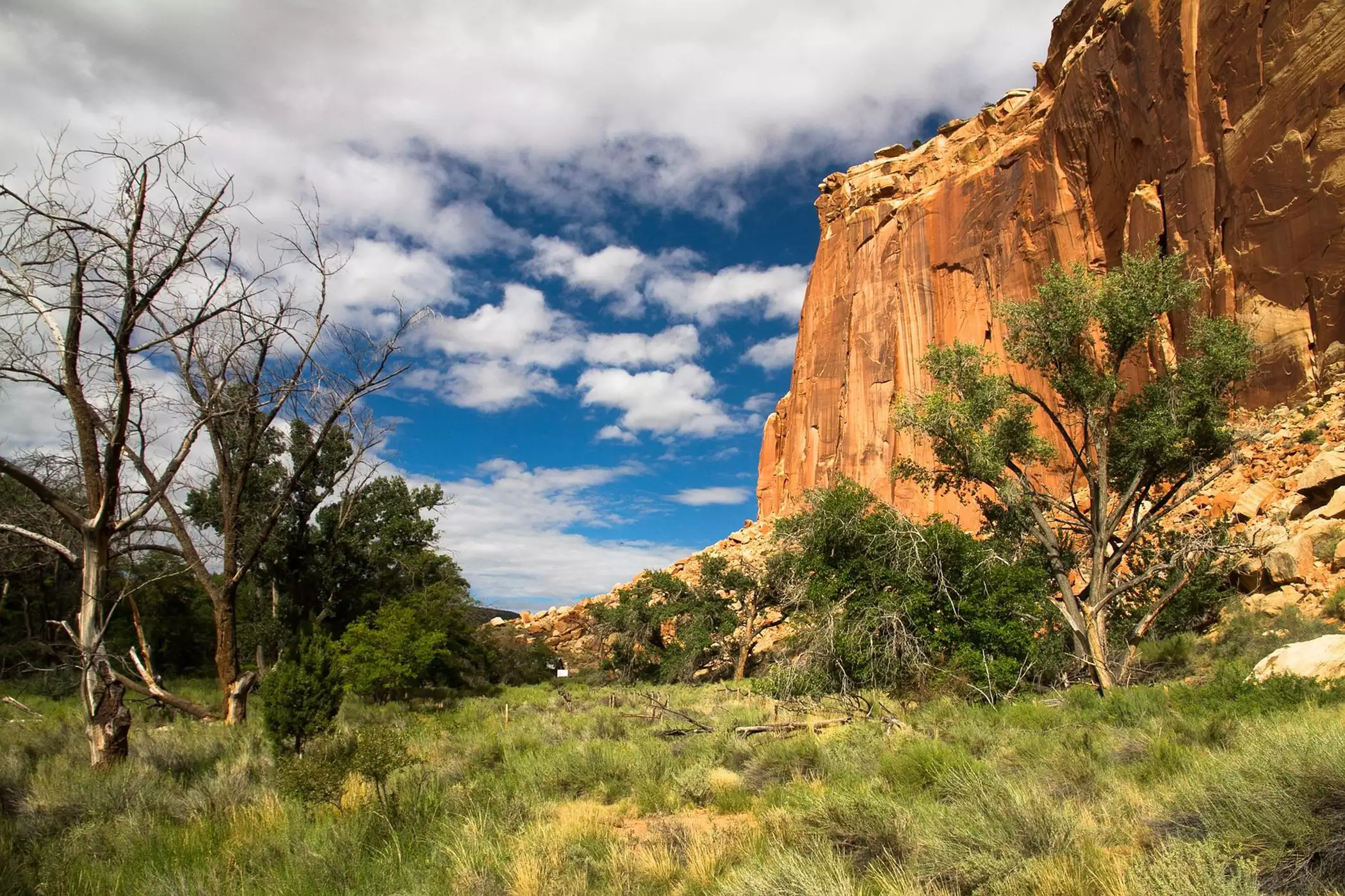
Capitol Reef National Park is one of Utah’s best-kept secrets, with hidden treasures and breathtaking surprises just waiting to be discovered and explored. Capitol Reef National Park’s landscape is dominated by the Waterpocket Fold, a geologic “wrinkle” in the earth’s crust that runs for 70 miles through the length of the park.
The Waterpocket Folds ridges, cliffs, canyons, and domes add dramatic beauty to the already magnificent landscape, proving there’s more to Capitol Reef National Park than meets the eye. Capitol Reef’s Scenic Drive is named that for a reason: it doesn’t get much more scenic than this. The Scenic Drive leads at Capitol Gorge, with soaring 1,000-foot-high Navajo sandstone walls, and the Golden Throne, one of Capitol Reef’s greatest monoliths. A spur trail to the Water Tanks reveals the water-filled “tanks” that give the Waterpocket Fold its name. Capitol Dome, the park’s namesake stone formation, is another must-see rock formation in Capitol Reef National Park.
The Grand Wash trail cuts through the Waterpocket Fold, gradually narrowing as hikers navigate through the Grand Wash canyon’s Navajo sandstone sheer vertical cliffs. On the ascent, a series of sandstone steps and ledges leads to massive Cassidy Arch. The scenery unexpectedly changes to pinyon and juniper forest at the junction with the Frying Pan Trail. Grand Wash continues through the hidden jewel of Cohab Canyon, then descends into Fruita via a series of switchbacks.
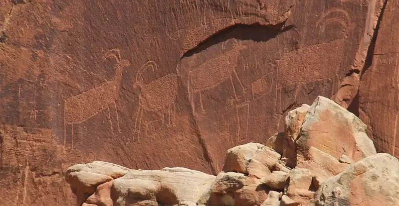
[custom-mapping map_id=”6744″ height=”400″]Here’s where another surprise awaits, as you don’t expect to see orchards in a Utah national park. But that’s what you’ll find in the Fruita section of Capitol Reef — more than 2,500 fruit and nut trees, in fact. The historic orchard has been continually cultivated since Mormon pioneers arrived in the mid-1800s — another jewel in Capitol Reef’s scenic crown. History buffs will enjoy seeking treasures of human existence accessible throughout Capitol Reef: the 1,000-year-old Fremont Indian petroglyphs; at Pioneer Register, where early Mormon pioneers carved their signatures in the sandstone; at the Behunin Cabin just off Highway 24 on the east side of the park; and at the historic Gifford Farmhouse south of the visitor center.
Heading back of the beaten path (not that many paths in Capitol Reef are all that worn) Burro Wash offers solace and solitude not found at many other national parks. The Burro Wash hike is an exciting experience of scrambling over boulders, wading through small pools of water, and squeezing through the Navajo sandstone narrows, opening to expansive views of the Waterpocket Fold.
Cathedral Valley’s massive monoliths accent the stark backcountry landscape. The main attraction here, besides the breathtaking landscape, is the absolute solitude of this remote area—a rarity in today’s harried lifestyle. Muley Twist Canyon offers another remote, challenging, and beautiful backcountry experience, showcasing the swirling effects of water erosion on the sandstone walls. In contrast, the Hickman Bridge Trail is probably one of the more frequently hiked routes, but in Capitol Reef National Park “frequent” is a relative term. The 2-mile out and back trail leads to views of Hickman Natural Bridge, the Waterpocket Fold, Capitol Dome, and the Rim Overlook.
Capitol Reef may be the least visited of Utah’s five national parks, but this hidden jewel is definitely worth a visit. Giving access to the southern end of Capitol Reef National Park, as well as access to Torrey via Scenic Byway 12, Boulder makes a great home base for exploring Capitol Reef National Park from Bryce Canyon Country.