

Alert: Construction Delays on Highway 89 Near Hatch Starting Oct. 5
Highway 89 Scenic Byway
Scenic Highway 89 through Bryce Canyon Country is part of the Utah Heritage Highway 89.Panguitch: The Center of Scenic Utah
Red Canyon
About a mile from the junction of Highway 89 and Scenic Byway 12 sits Red Canyon, known for its vivid red rock spires and hoodoos. The highway itself passes through natural rock arches carved into the canyon walls. It's an easy stop for photos, short trails, and a preview of the color and geology you'll see again at Bryce Canyon.
Hatch
At the junction of Mammoth Creek and the Sevier River sits Hatch, Utah, a small pioneer community with a big list of nearby attractions: Mammoth Cave, Red Canyon, the Dixie National Forest, and the Sevier River drainage. The Mammoth Creek Fish Hatchery, located here, stocks rainbow trout in lakes and streams throughout the region, making it an excellent fishing stop. The town also offers ATV riding, snowmobiling, hiking, and mountain biking, a 1950s-style Galaxy Diner, and a handful of lodging and dining options. By appointment, visitors can tour the Daughters of Utah Pioneer Museum, and a seasonal U.S. Forest Service visitor center sits just south of town to help travelers get oriented.
Mammoth Cave: One of Utah's Largest Lava Tubes
West of Hatch via Fish Hatchery Road, Mammoth Cave is a lava tube on the Markagunt Plateau at over 8,000 feet elevation, with more than 2,000 feet of explorable passages across several chambers. It formed from cooling lava and water and stays cool year-round.
This is a self-guided adventure, so bring a flashlight or headlamp for every person (it's pitch dark past the first turn), sturdy shoes, and a jacket. The access road is paved for the first several miles out of Hatch and turns to dirt for the final stretch, so it's worth checking conditions before heading out, especially after rain or snow.
Best Time to Visit
- Late spring–fall: Enjoy full access to Mammoth Cave's dirt access road and the best conditions for exploring Red Canyon's trails.
- Summer: Enjoy peak fishing season around Hatch and the Mammoth Creek drainage, plus the warmest temperatures for cave exploration.
- Winter: Highway 89 stays open and plowed, and the Hatch area is a hub for snowmobiling, but Mammoth Cave's access road may not be maintained for winter travel. Check conditions first.
Make the Most of Your Trip
This section of Highway 89 connects north to Panguitch and Scenic Byway 143, and south toward Zion National Park and the North Rim of the Grand Canyon. It also meets Scenic Byway 12 near Red Canyon, making it easy to build a loop that includes Bryce Canyon National Park, Kodachrome Basin, and points further into Garfield County.
FAQ: Planning Your Drive on Highway 89
What is Utah's Heritage Highway 89?
Utah's Heritage Highway 89 is a 500-mile route from Idaho to Arizona. The Bryce Canyon Country section runs through Panguitch and Hatch, Utah.
How far is Hatch from Panguitch?
Hatch is about 15 miles south of Panguitch.
What is Mammoth Cave?
Mammoth Cave is a self-guided lava tube west of Hatch, Utah, with over 2,000 feet of passages formed from ancient lava flows. Bring a flashlight and sturdy shoes. There are no tours or staff on-site.
Does Highway 89 connect to Zion National Park?
Yes. Heading south from Hatch, Highway 89 continues toward Zion National Park and the North Rim of the Grand Canyon.
Is Red Canyon on Highway 89 or Highway 12?
Red Canyon sits right at the junction of the two, about a mile from where Highway 89 meets Scenic Byway 12.
Can I visit Mammoth Cave in a regular car?
The first several miles from Hatch are paved; the final stretch is dirt road. It's passable for most passenger vehicles in dry conditions, but check current conditions before heading out, especially after rain or snow.
This information is provided by Bryce Canyon Country, the official tourism office of Garfield County, Utah

Related Lodging, Dining, & Guides.
Calf Creek Campground

The Lamplighter Lodge
Sculptured Furniture, Art & Ceramics Gallery

Bear's Den Cafe


Tropic Family House

Ofland Escalante

Canyon Base Camp

Boulder Mountain Guest Ranch


Dining Room at The Lodge at Bryce Canyon


Bryce Riverfront Urban Industrial House

Amy's Door

Triple C Arena

Escalante Doggie Day Care

The Burger Barn

Pine Lake Campground

The Grill at Offshore Marina

Roasted Root Cafe


Grand View Lodge

Sunrise Hollow - Rosewood Cabin

Bryce Canyon Country Rodeo

Bryce View Lodge


Red Ledges Inn

Off the Grid in Rock Canyon

Panguitch Lake Resort Boat Rentals

Bryce Canyon Motel

Mammoth Creek RV Resort

Best Western Plus Ruby's Inn

American ATV Rentals


Ranger Dave's Historical Cabins


Canyon Base Camp
Wide Hollow Campground

Garfield Memorial Health Care Foundation Thrift Store

Wanderlust Cowgirl Coffee

Bryce Canyon Falconry

Sky Nova Bar & Grill

Southwestern Retreat

Charming Country Bunkhouse

Bryce Canyon Pines Cottages

Boulder Meadows RV & Campground

Beautiful South Utah Custom Home

Canyon Fever Guides


Bryce Canyon Helicopters

Bryce Canyon Trading Post

Escalante Outfitters


Boulder Mountain Guest Ranch

The Bistro at Ticaboo Lodge


Bryce Canyon Pines Lodge

Ruby's Inn Cowboy's Buffet & Steak Room

Yoga at Clear Sky

Ruby's Inn Rustic Log Cabins

Bear Valley RV & Campground

New Western Motel

Valhalla Pizza

Bryce Pioneer Village Cabins

Stone Canyon Inn

Red Canyon Village Cabins

Panguitch Lake Resort
Blue Spruce Campground

Under Canvas Restaurant

Bear Valley RV Cabin

Bryce Canyon Resort Hotel

Escalante Showhouse

Coyote Hollow Equestrian Campground

The Bullberry Inn

Sunset Campground


Ruby's Inn Winter Activity Center

Rockin' R Ranch Arena


Bear Paw Cabins

Bryce Wildlife Outfitters

The Loubird Inn

Utah Fishing Charters

Panoramic Cliffs Retreat

Sevier Coffee Co. & Cafe

Red Canyon Village RV Park

Hell's Backbone Ranch and Trail

Charming Tropic Home by a Farm


Steppingstone Inn

Paradise RV Park & Campground

Posey Lake Campground

Bear Paw Resort RV Park

The Pink Polka Dott
Distances marked "Varies" depend on your chosen route and turnaround point — check current trail maps for exact mileage.
ATV and OHV riding is not permitted off-road inside Bryce Canyon National Park itself. All trails listed here are on National Forest or BLM land surrounding the park.
Before You Ride
OHV operators ages 8–15 must have an OHV education certificate from the Utah Division of Parks and Recreation. Operators 16 and older must have either a valid driver's license or an OHV education certificate. No one under 8 may operate an OHV on the county road system.
Yankee Meadows Ride
This scenic ride follows the south shore of Panguitch Lake, leading to Clear Creek Road and the Yankee Meadow Reservoir overlook. The trail is heavily forested with switchbacks, opening to sweeping views of Bryce Canyon Country's red rock landscape. Yankee Meadow Reservoir is a good spot to stretch your legs and use the facilities before continuing another mile to an open meadow that's ideal for picnicking.
Bull Rush Loop
Bull Rush Loop is a challenging, scenic ride through thick forest and sagebrush hills, with narrow stretches and a rocky, vertical descent into a dry wash. Bull Rush Peak tops out at 6,380 feet.
Casto Canyon / Limekiln Loop
A full day of riding awaits on the 90-mile Casto Canyon / Limekiln Loop, which begins and ends in Panguitch. The route winds through Casto Canyon and intersects the Fremont Trail near Circleville, roughly the halfway point and a good stop for lunch. Casto Canyon's red rock formations rival Bryce Canyon National Park's, and the trail is widely regarded as one of the most scenic ATV routes in the country. Forest cover shifts from pinyon pine and juniper to Ponderosa pine, Douglas fir, and aspen as elevation increases, making this a strong trail for wildlife viewing. The return leg passes through Dog Valley, crosses Highway 89, and follows Sandford Creek back to Panguitch.
Paunsaugunt ATV Trail
Covering 25–30 miles of open desert terrain in the Powell Ranger District of Dixie National Forest, the Paunsaugunt ATV Trail is known for red rock vistas stretching across the forest, making it a good option for riders looking for wide-open exploration outside the park boundary.
Fremont ATV Trail
The Fremont ATV Trail winds through dusty, shaded desert forest, high plateaus, and quiet backcountry. It's a good pick for riders seeking seclusion and a chance to spot wildlife.
Pine Lake OHV Trail
Pine Lake OHV Trail makes a loop from Pine Lake up to Powell Point and around through Pole Canyon before returning. It’s a classic stretch of Utah backroad riding.
Powell Point
Located about 23 miles northeast of Bryce Canyon National Park at the southern tip of the Table Cliff Plateau, Powell Point offers one of Southern Utah's most dramatic overlooks, with views stretching across the Grand Staircase and the Gray and White Cliffs before dropping toward the Grand Canyon in the distance.
Bryce ATV Rally
Every August, riders gather in Panguitch for the annual Bryce ATV Rally, hosted at the Triple C Arena. The 2026 rally runs August 13–15. The rally offers guided tours and independent exploration across more than 2,400 miles of trail, including Casto Canyon. Highlights include an ATV Rodeo, a Poker Run with cash prizes, vendors, food, and entertainment for the whole family.
Garfield County ATV & OHV Route Maps
Explore over 3,000 miles of scenic trails across southern Utah with our four-part map guide:
- Region 1: Markagunt & Paunsaugunt Plateaus (Panguitch Lake, Hatch, and loops near Bryce Canyon)
- Region 2: Aquarius Plateau & Escalante (Boulder Mountain, Hell's Backbone, and Grand Staircase-Escalante)
- Region 3: Escalante to Ticaboo (canyons, remote desert trails, and the Waterpocket Fold corridor)
- Region 4: Henry Mountains & Lake Powell (high-elevation mountain trails, bison country, and Bullfrog area access)
FAQ: Riding ATVs in Bryce Canyon Country
Do I need a permit to ride ATVs in Bryce Canyon Country?
You'll need a registered OHV and, since 2023, Utah requires all operators to complete an approved OHV education course. Check current requirements before you ride.
Can I ride ATVs inside Bryce Canyon National Park?
No. Off-road OHV riding is not permitted inside the national park. All trails on this page are located on surrounding National Forest or BLM land.
What's the best ATV trail for beginners?
Yankee Meadows Ride offers scenic, forested riding with fewer technical sections than routes like Bull Rush Loop or Pine Lake OHV Trail.
How long is the Casto Canyon / Limekiln Loop?
About 90 miles round trip, starting and ending in Panguitch. Plan for a full day.
Are there annual ATV events in the area?
Yes. The Bryce ATV Rally takes place every August in Panguitch at the Triple C Arena, with guided tours, a Poker Run, and access to over 2,400 miles of trail. The 2026 rally runs August 13–15.
Provided by Bryce Canyon Country, the official tourism office of Garfield County, Utah


Casto Canyon Day Trips for Days Itinerary
Related Lodging, Dining, & Guides.
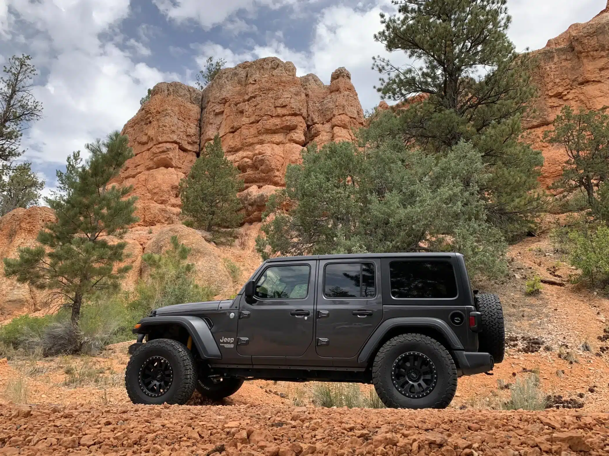
Epic Jeep Rentals


Mystic Adventures
American ATV Rentals
Grand Staircase ATV Tours
Bryce Wildlife Outfitters

Bryce UTV Rentals
