
Bryce Canyon Country boasts a number of small creeks and streams that offer abundant fishing in pristine waters surrounded by beautiful and diverse scenery.
Trout fishing is at its best here, with both wild and stocked populations of rainbow, brown, cutthroat, and brook. Local outfitters can supply maps and fishing licenses.
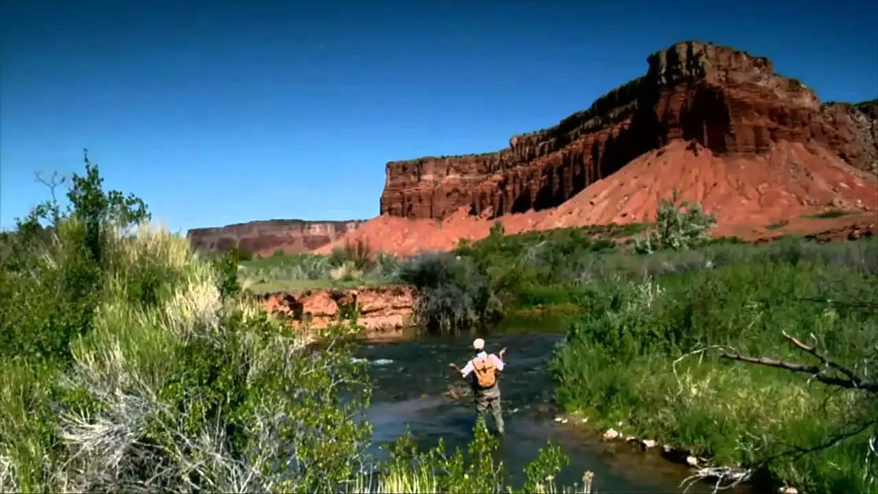
Antimony Creek is located just south of the bucolic community of Antimony and Otter Creek State Park. At an elevation of 6,500 feet and just thirty feet across at its widest, the small but productive coldwater creek is a quiet fishing spot nestled in the shade of cottonwood and willow trees. Fly fishing is popular here, with wild populations of rainbow and brown trout averaging ten to twelve inches in length. Antimony Creek, located in Dixie National Forest, can be reached by vehicle and then by foot via an unpaved road. From Antimony, head south for three miles to the Dixie National Forest boundary, then travel east on Forest Service Road 138.
The East Fork Sevier River runs upstream from Tropic Reservoir for fifteen miles. Located just west of Bryce Canyon National Park, most of the high-elevation stream (7,800 to 8,400 feet) is located on Dixie National Forest public access lands. The pristine waters feature abundant populations of wild brook and cutthroat trout, as well as some wild brown and stocked rainbow, especially downstream near Black Canyon. Trout here typically range from eight to fourteen inches long. The East Fork Sevier River creek is accessible by gravel road between Antimony and Bryce Canyon mainly during the summer months, with road closures limiting winter fishing. Some of the lower section of the stream is located on private land. Tributary streams such as Robinson Canyon, Crawford Creek, and Podunk Creek also contain abundant trout populations, with most of the fishable waters located above Kanab Creek.
Mammoth Creek is located fifteen miles south of Panguitch. At an elevation range of 6,900 to 9,680-feet, most of the 23-mile long stream is located on private lands. Wild brown trout and hatchery-stocked rainbow trout are the most likely catches in Mammoth Creek, with occasional brook trout, cutthroat trout, and mountain whitefish. Large trout up to 19 inches long often populate the nine-mile section between Hatch Meadow and Canal Diversion. The upper Sevier River forms at the confluence of Mammoth Creek and Asay Creek, where brown trout fishing peaks during late fall, winter, and early spring. The extreme upper end of Mammoth Creek is located within the Dixie National Forest, and the lowest end falls on public BLM lands. Public access is available west of Highway 89. Most of Mammoth Creek is accessible on foot, although anglers should obtain permission before entering private lands and obey no trespassing signs when posted.
Panguitch Creek extends from Panguitch Lake to the Sevier River near the town of Panguitch. Following Scenic Highway 143 for several miles, the creek flows through Dixie National Forest, private lands, and a five-mile section of the remote canyon. Cutthroat trout once populated the waters but now Panguitch Creek is primarily stocked with hatchery rainbow trout, especially along the highway section. Wild brown trout populate the lower section of Panguitch Creek.
Please do your part to preserve Bryce Canyon Country’s creeks and streams by picking out what you bring in. Keep in mind that creek water is non-potable and must be purified before drinking.

